
ARROWSMITH Aaron
Scheda: 62468
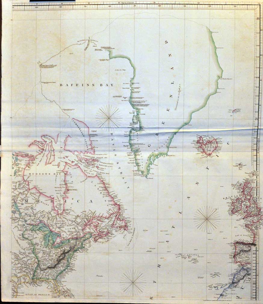
HYDROGRAPHICAL CHART OF THE WORLD.
According to Wrights or Mercators projection. Delineated by A. Arrowsmith.
A. Arrowsmith (10 Soho Sq,), London, 1811.
790,00 €
Bella carta nautica, inc. in rame e a colori, di cm. 78 x 73. E' dedicata alla "Costa Orientale del Nord America e alla Groenlandia".Cfr. Tooley's Dictionary of Mapmakers, p. 24: Aaron Arrowsmith (1750-1833), English cartographer, engraver and publisher. in 1790 he set up his own establishment in London and he became hydrographer to Prince of Wales ca. 1810 and to His Majesty 1820. In all he issued 200 maps, mostly large scale, and was easily the foremost cartographer of his time. Esemplare ben conservato.
NORD AMERICA COSTA ORIENTALE GROENLANDIA CARTA NAUTICA 1800 \
ARTE GRAFICA
